About BC Books Online
BC Books Online was created for anyone interested in BC-published books, and with librarians especially in mind. We'd like to make it easy for library staff to learn about books from BC publishers - both new releases and backlist titles - so you can inform your patrons and keep your collections up to date.
Our site features print books and ebooks - both new releases and backlist titles - all of which are available to order through regular trade channels. Browse our subject categories to find books of interest or create and export lists by category to cross-reference with your library's current collection.
A quick tip: When reviewing the "Browse by Category" listings, please note that these are based on standardized BISAC Subject Codes supplied by the books' publishers. You will find additional selections, grouped by theme or region, in our "BC Reading Lists."
Shortlisted for the 2014 City of Victoria Butler Book Prize
Shortlisted for a 2014 BC Book Prize
Finalist for the Lieutenant-Governor's Medal for Historical Writing
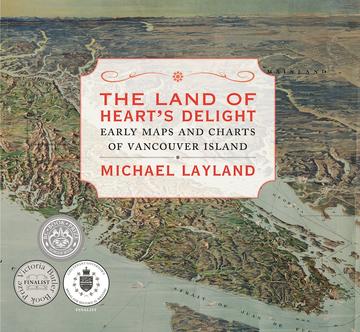
Just how, and why, did Vancouver Island get onto the map? How was knowledge of our immediate geography acquired and recorded? With 130 maps, dating between 1593 and 1915, this cartographic history tells the story of how Vancouver Island and the surrounding area came to be mapped. The book shows local cartographic milestones, marking progress in our knowledge through the island’s rich—although comparatively short—recorded history. However, the maps, by themselves and without context, cannot tell the whole story. The accompanying text reveals the motives, constraints, agendas, and intrigues that underpin their making.
The narrative, roughly chronological, begins before the arrival of Europeans and concludes at the outset of the First World War and includes an introduction on the history and significance of map-making, as well as an afterword summarizing subsequent cartographic developments. Also included are an index, endnotes, a list of cartographic sources, and a glossary.
- Short-listed, Lieutenant Governor's Medal for Historical Writing
- Short-listed, Bill Duthie Booksellers Choice Award, BC Book Prize
- Short-listed, City of Victoria Butler Book Prize
"[A] meticulously researched and lavishly illustrated book." —The Coastal Spectator
Michael Layland joined Annette Lucas on Go! Island to speak about his love of maps, his passion for history, and what inspired his new book, The Land of Heart's Delight: Early Maps and Charts of Vancouver Island.
The Land of Heart's Delight shortlisted for the BC Book Prize Bill Duthie Booksellers Award.
The Land of Heart's Delight awarded second place for The Lieutenant Governor's Medal for Historical Writing by the BC Historical Federation.
"The Land of Heart's Delight is filled with dozens of details that help provide a better sense of where we live . . . It's next to impossible to understand our history without first understanding our geography, and maps hold the key to that knowledge." —The Times Colonist
The Land of Heart's Delight shortlisted for the City of Victoria Butler Book Prize.
"In his foreword, Derek Hayes describes Layland as the foremost map historian of Vancouver Island. Any reader who encounters the sophisticated concision of Layland's commentary will be hard pressed to imagine otherwise. We get the comfortable feeling that Layland might like maps more than he likes people." —BC BookWorld


