Transportation


Land Here? You Bet!


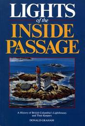
Lights of the Inside Passage
Dreadful as it was, the West Coast of Vancouver Island still remained British Columbia's safest shipping freeway well into the late 1890s. The alternative was the Inside Passage, that long corkscrew course setting the Island apart from the mainland. It was perilous enough in daylight, with tides pulsing and ripping through compressed channels. After sunset, or in fog, it was near madness to venture by echo and lead-line up the Strait of Georgia and into the maze of islands clogging Johnstone Strait. As one captain recalled, "Any black dark nights they just had to tie up because there's no lights anywhere . . . you just had no hope. You couldn't see." Besides, shipping lanes intersected in the Passage. Vessels travelling back and forth from Vancouver and the Fraser to Nanaimo, Chemainus, and Victoria cut across the bows of others bound north and south. It was a busy intersection with no traffic lights.
In the mid 1880s the Department of Marine and Fisheries began setting up lights for traffic crossing the Straits. Once out of Victoria, captains steered past Fiddle Reef and around Trial Island, then headed for Discovery Island light at the entrance to Haro Strait. Three courses lay before them: Boundary Pass, marked by the East Point light on Saturna Island's southern tip; Active Pass, via Portlock Point and Active Pass lights; or Porlier Pass, separating Valdez and Galiano Islands. Within a decade, though, most traffic was heading north from Vancouver in a motley convoy through the Inside Passage towards the Klondike.
As late as 1898 Point Atkinson was still the furthest light north. In May 1904 the Victoria Colonist reported, "An agitation has been started looking to induce the Dominion government to construct additional lighthouses on this coast." Polite petitions, and not-so-veiled political threats were pouring into the office of Colonel W.P. Anderson, chairman of the Canadian Lighthouse Board, and chief engineer of the Department of Marine and Fisheries. The lighthouse board sat in marathon sessions to keep pace with the paper. Echoing the sentiment of every Chamber of Commerce from Victoria to Port Alice, the Vancouver News-Advertiser declared, "We have a strong claim on the Dominion government for such expenditure as this," since federal coffers were already swollen with levies from British Columbians "in the shape of customs and excise dues, fishery licences and other items." The Colonist warned British Columbia's MPs to "see to this matter before the present session . . . closed."
Colonel Anderson weathered the siege, and his draftsmen worked overtime, cranking out plans. In a frenzy of construction they put up seven lights in ten years along the Island's eastern flank. When the construction crews left, three hundred miles of sheltered waterway were rendered safe, from the Ballenas Islands off Parksville, to Pine Island at the north end of Gordon Channel, near the top of Vancouver Island. Beacons on Ballenas Island and Sisters Rocks warned ships away from perilous rocks and foul ground. All the others, from Merry Island to Pine, gave crucial bearings for steering through the fast-running channels and passes. Ships went from one light and fog signal to the next, all the way north to the heaving Hecate Straits. There were still six hundred miles to go for the gold.
Active Pass
Every B.C. ferry on its run from Tsawwassen to Swartz Bay threads through the boiling tide of Active Pass between Mayne and Galiano Islands, slowing speed and blasting its whistle to warn unwary smaller craft around the bend of its approach. The sight of the tower and buildings of Active Pass light seldom fails to draw passengers out on deck, many for their first look at a "real" lighthouse.
Though its title certainly befits one of the busiest shipping routes crossing Georgia Strait, the Pass was actually named for the American steamer Active, one of the earliest steamships to pass through while engaged, with HMS Plumper, in surveying the international boundary in 1857. In the course of that survey the Plumper's officers apprehended an American whiskey trader named Macaulay, who unknowingly played a key role in the expansion of the lighthouse network. After he was transferred to the Active, Macaulay flashed a large quantity of gold dust and nuggets, taken in trade from Indians up the Fraser River. When the Active berthed at San Francisco, Macaulay started talking and the Fraser gold rush was on.
Sailing ships had previously shunned Active Pass because of its strong rip tides and its narrow clearance of less than a third of a mile. In July 1860 the man-of-war Termagant, en route to Nanaimo to take on coal and to impress restive Indians with white supremacy, grazed Laura Point and carried away some trees with her foreyard. Twelve years later the bark Zephyr, bound for San Francisco with a hold full of sandstone, raked out her bottom on Georgina Shoals in a snow squall and went down with her captain and a deckhand. In 1898 the B.C. Coast Pilot warned that strong tides combined with slack winds to render the Pass "unsafe for sailing-vessels, unless indeed small coasters." For moderate-sized steamships "commanding a speed of not less than 8 knots, it is a useful pass," the Pilot allowed, "but it is advisable for large ships and those deeply laden to pass through at, or near slack water."


